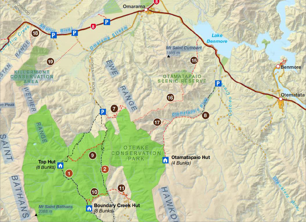
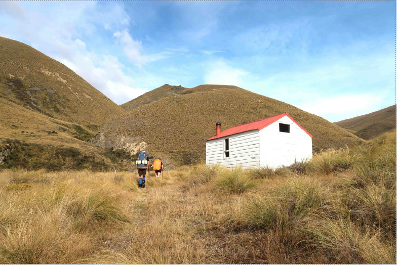
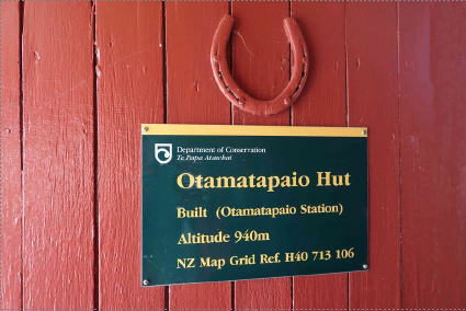
At the end of Backyards Road near Sailors Cutting an easement over farm land leads to the large Oteake Conservation Area that was created as a result of the tenure review of Otamatapaio Station completed in 2005. Three old musterers’ huts were built up the valley through which the Otamatapaio River runs: a stone hut and two wooden ones that were known to musterers and fencers as the ‘Blue’ and ‘Pink’ huts. Since the ‘Pink Hut’, the one furthest up the valley, lay within the newly formed Conservation Area DOC fully renovated the interior with a full ply lining, new bunks, a stainless bench, ply table and benches, aluminium window frames and, in 2006, added a wood burner (though there’s no wood anywhere near!) These days it is a standard 4-bunk DOC hut.
We left Timaru at 7.30 am and arrived two hours later, parking after the cattle stop of the road on the right. Just as we were getting ready to leave the vehicle another car pulled up. With it being such a small hut it was good to see that the driver was on her own. To alleviate any concerns Susan immediately said that she was carrying a tent. (Each member of our group was carrying a tent too since there was no way of knowing whether there might be a group walking from the 4WD carpark five kilometres up the track.)
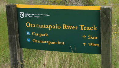
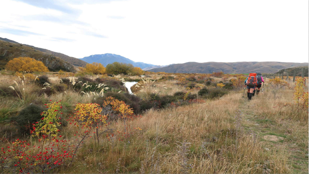
The 15 km trek to the hut follows an old farm track, for the first few kilometres beside a deer fence and all the way close to the river that had to be crossed several times.
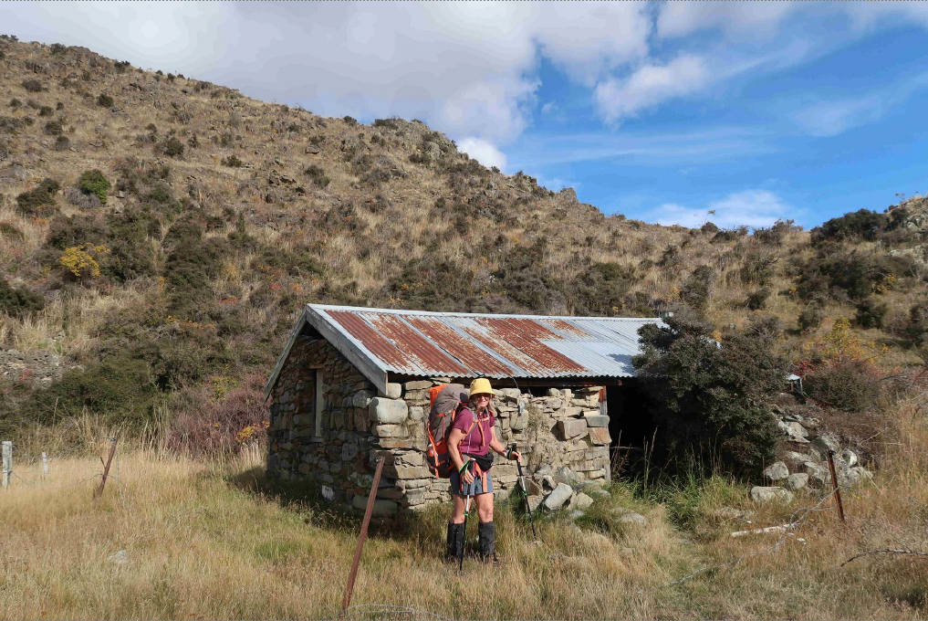
We peeped inside the now-derelict Stone Hut and saw that it had two bunks and an open fire place. Hazel posed for a photograph. While stopped for a break and snack by the hut Susan joined us and from here we walked on together.
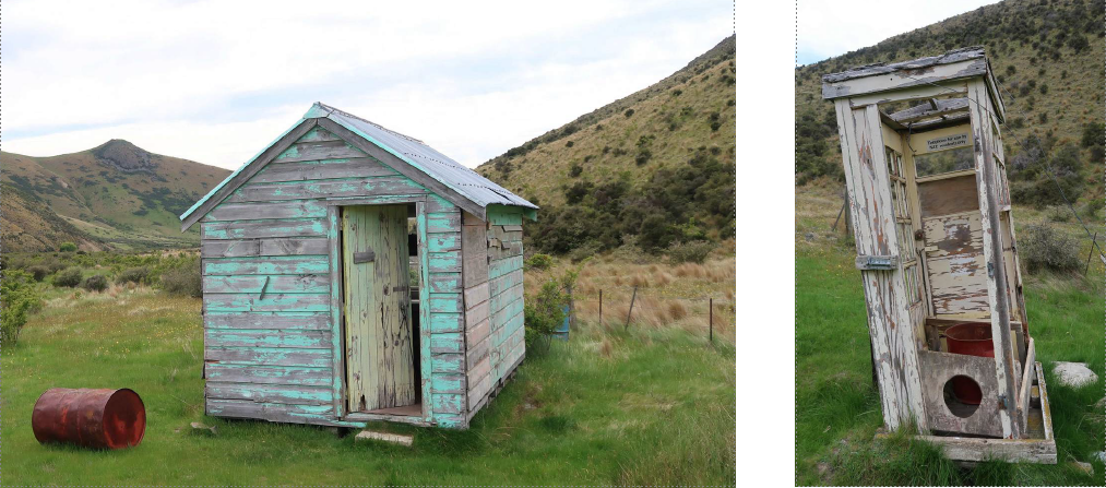
We detoured a short distance to the “ Blue Hut” with its orange carpet and 1950s furniture. The old telephone box with a sign inside saying, “Telephone for use by NZE residents only” once served as the toilet.
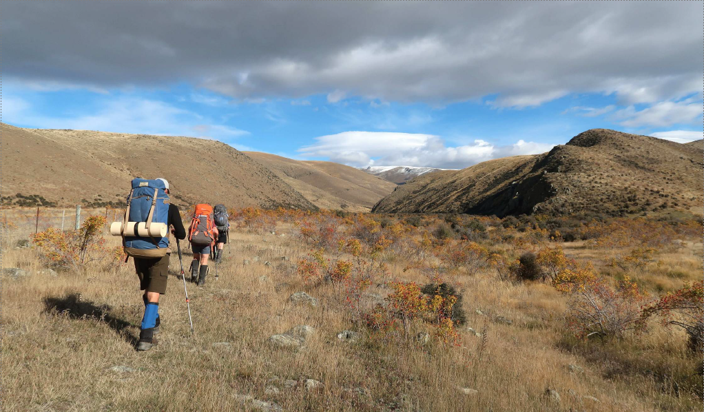
The track was water-laden and boggy in places and with all the river crossings there was no way of keeping dry feet but at last the hut came into view and we arrived at 5 pm. It had been a six hour walk.
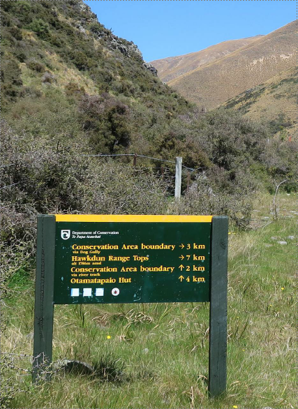
The second day we walked 4 km back down the valley to Dog Gully. The sign said it was 3 km to the Conservation Boundary and from there another 4 km to reach Point 1780 m on the Hawkdun Range Tops so a long 7 kilometres. This route follows another old 4WD farm track and is marked with orange markers, many of which had fallen down (and were put back in place by Hazel, Catherine or Mark.)
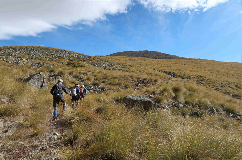
Leaving the valley floor we began the climb to the Conservation Area that was marked with a sign at a boundary fence. From there we continued steadily upward for about another 3 km.
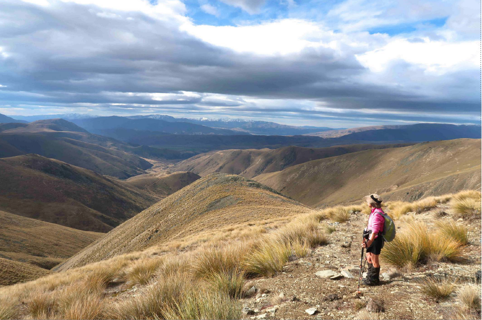
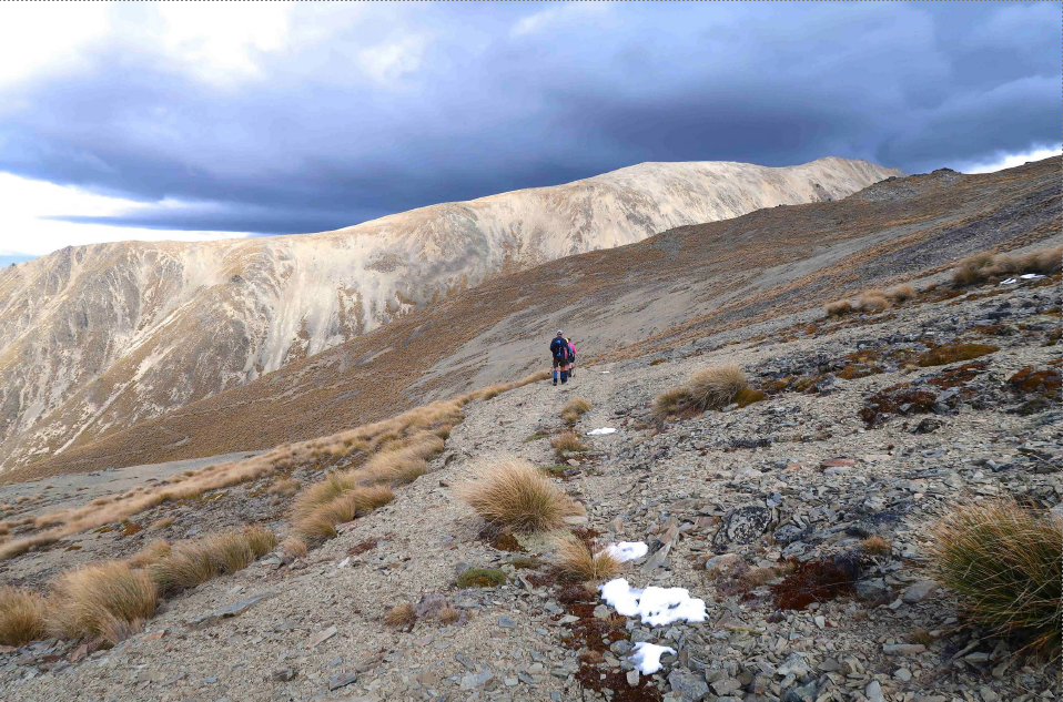
At about 1 pm when we realised that there was probably still about another kilometre to go to reach the top of the Range, the decision was made to turn back. Disappointing, but sometimes our goals are not always attained. We had enjoyed views of a small section of the Southern Alps and good views to the north that included Lake Benmore and the Kirkilston Range behind it. Besides, we had climbed high enough to see patches of snow.
We arrived back at Otamatapaio Hut after a nine hour day, having covered nearly 20 kilometres.
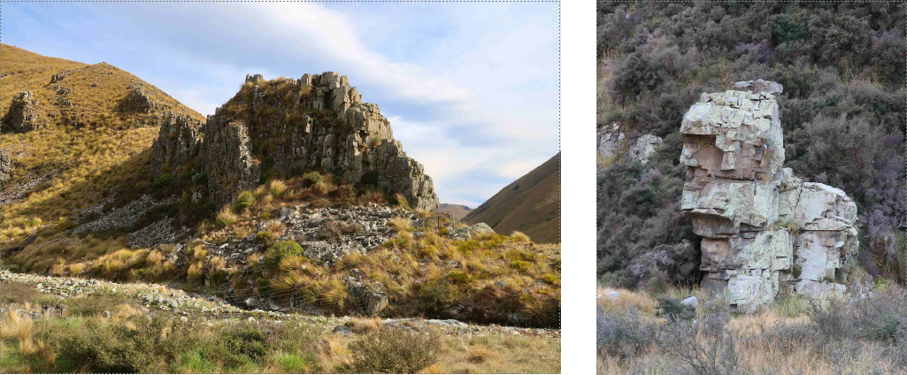
On Monday we were away from the hut at 8 am. As compared with a springtime hike in this area we couldn’t help but comment on the golden landscape: the yellow leaves of the rosehip bushes still holding their bright red berries; the willow trees in the riverbed with their golden leaves and even the grass which had a golden hue. Another stand-out feature were the rocky outcrops. We smiled at one that looked like a lego bear.
Gradually losing altitude, it was a pleasant walk down the valley to the vehicle which we reached at 12.30 pm. After a bite to eat and a short stop at Kurow we were back in Timaru before 4 pm.
Many thanks to Catherine for organising this trip.
Reporter: Dorothy T